|
| Lizardhead Mtn and the Cirque |
Being in the mountains for an extended period will change you. I was having dinner with some friends the day I got back from this trip. I was trying to explain to them the change that takes place in the mountains (I would guess any remote outdoor environment). I told them that being out there away from all the control we have imposed to make life seem safe and predictable, away from the insulation we have created to isolate one from the harshness of "the real world", the comforts, safeguards, distractions (tv and computer), and away from the daily bombardment from a culture sickened by greed, you find the time to think about some very important and basic things. You begin to realize how utterly out of control we really are despite all the effort to control. You realize from observing the billion year old mountain range how insignificant one is and how fast life passes by. And by walking through fields of blue bells and indian paintbrush and giant fir forests and observing the incredible natural beauty that this planet has, you realize how precious your life is and how privileged we all are to be a part of it. I told them these observations create a keen focus on the really important things in life; family, friends, and spirituality. And the strong belief that we better take care of this planet, our home. Being in the wild changes me for the better. It gives me a renewed focus on what is important. It is often emotional for me to drive back home from an outdoor adventure. I can't wait to get home and see my family and friends and try harder to be a better person and to focus on the things in life that really matter. After I finished telling my story I noticed the blank stares I was getting from my friends. I guess you have to experience it for yourself to really understand it.
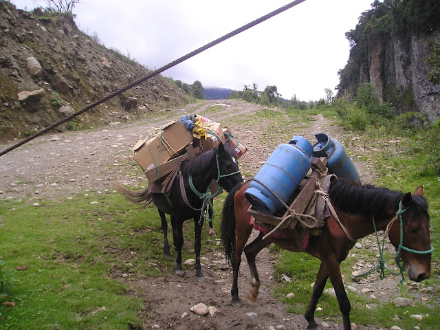
I had planned a Wind River Mountain Range traverse for almost a decade. It all came together on a Monday in August 8, 2011. My bother Pete and I started hiking Monday morning at 7 am at the Worthen Meadows Reservoir trail head. We had planned for food for ten days. Knowing that we would need 2 lbs of food per day, we each were carrying about 20 lbs of food. We had bought some lighter gear to make our load lighter: a Nemo 1 person tent, a Western Mountaineering Sycamore 25 degree sleeping bag, a Gregory Baltoro 70 backpack, and a Soto cook stove. We weren't ultra light but much lighter than I had ever been for this length of trip. We ended up carrying about 45 lbs to start the trip. We brought water purification tablets but at the last minute I threw in my Katadyn Basecamp gravity feed bag water filter and I am so glad I did.
 |
| Sheep Bridge over Middle Fork of the Popo Agie River |
Day 1: Worthen Meadows Reservoir to Pinto Park Lake
The Sheep Bridge Trail heads north from Worthen Meadows Reservoir. It ends at the bridge that spans the middle fork of the Popo Agia River where it connects with the Middle Fork Trail. There it heads west towards Three Rivers Park, which makes a good lunch stop along the Middle Fork of the Popo Agie. Here we took the Pinto Park trail and camped one mile shy of Pinto Park at the junction of Pinto Park trail and Deep Creek lakes trail. We opted to camp there fearing there would be
 |
| Pinto Park Lake |
no water on top at Pinto Park. Pinto Park lake was I nice side hike with a very good swimming hole to bath in. Our first day was about 9 miles and 7 hours of hiking. Living in low altitude, we thought it best to start slow and end fast if we had to.
 |
| A view of Lizardhead Mtn. and the Cirque from Pinto Park |
Day 2: Pinto Park to Lizardhead Meadows
This was our easiest day of hiking and we covered only 7.5 miles. We knew Lizardhead Trail was going to be tough and wanted a good rest the day before we did it. Also, Lizardhead Meadows is beautiful and we wanted time to take it in and fish the North Fork of the Popo Agie. We saw our first look it the high peaks at Pinto Park. It is just a spectacular view there. From there the trail is down hill until you reach the North Fork of the Popo Agie River. There you go west on the North Fork Trail, which is a beautiful hike along this magnificent river. It day ended with the spectacular setting of Lizardhead Meadows
|
|
Lizardhead Moutain at Lizardhead Meadows
|
Day 3: Lizardhead Meadows to Ranger Park
We left around 8 am and headed up Lizardhead Trail from the meadows. The trail is steep with spectacular views of the cirque and surrounding granite walls. It took us about 2 1/2 hours to make the top of windy mountain. This mountain is flat and massive with about a 4 mile hike to Bears Ears Trail which leads past Valentine Lake and down into Ranger Park.
 |
| A look from Lizardhead Trail as we climb up to Windy Mtn. |
 |
On top of Windy Mtn with the summit of Lizardhead in the background.
|
 |
Looking down toward Ranger Park in the valley from Windy Mtn.
|
 |
| The rough and rugged Bears Ears Trail |
 |
| A great camp just above Ranger Park |
Day 4: Ranger Park to East Fork River on the Fremont Trail
This early morning hike along Washakie, Macon, and Pass Lake was just magical. It was one of the most beautiful walks through the woods I have ever made. The weather was perfect and the scenery devine.
 |
| The gateway into a beautiful world |
 |
| Buffalo Head Mtn near Ranger Park |
 |
| Washakie Lake and Mtn in the background |
 |
| Looking back toward Ranger Park on our way to Washakie Pass |
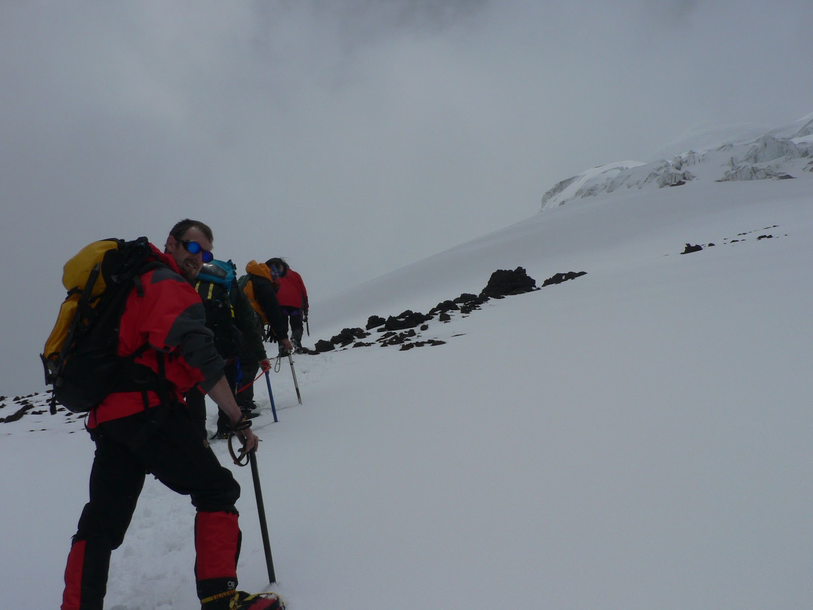
After walking through this beautiful area we passed Macon Lake and started a steep climb toward Washakie Pass all the time looking at a formidable obstacle along our path. The upper reaches of the pass was snow packed. We didn't have any tools to deal with this (crampons or ice axe) so we were a bit nervous. After reaching the snow we took a good break and watched a Colorado group work their way up the snow with helmets on and ice axes in hand. We then made our way up our chosen route. I lead kicking steps along the way. It was going fine until I hit ice that was hidden under 2 inches of snow. I told Pete we had a problem. Luckily the ice was along a ridge and just feet above this ice was a very flat area. I told Pete we were going to flop ourselves over this thin section of ice and not place our feet on it at all. We did and it worked. As we made our way to the top, a middle aged couple was coming down. I told them about the ice and where it was. They were so nonchalant it worried me. After we made the rocks we sat down and watched as they approached the section of ice. They walked right onto it and she slipped and landed on her rear and started to slide. He managed to catch her, if not she had a 60 foot slide into granite rocks. I waited until they had safely made it off the snow before we left. I had a FindMeSpot that could call in rescue and was relieved I didn't have to.
 |
| I hiking couple just before a slip on the ice |
We continued on the western side of Washakie Pass and headed toward the western side of the Cirque. There we turned west up Washakie Creek toward the East Fork River where we made camp on the edge of a beautiful park. I had good luck fishing in the East Fork.
 |
| Looking toward the East Fork River from camp |
 |
| East Fork River |
Day 5: East Fork River to Lake Susan
We were excited to get on the Highline Trail today and get on some flat land with easier hiking. We were in for a surprise. We started the morning climbing a hill to get on the high plain above. After making the top our spirits were high seeing the flat beautiful meadow with fantastic views all around. Our feet were aching due to the rough trails we had traveled. The pack animals and vibram soles had taken a toll on the trails and granite rocks tripped and twisted the ankles mercelessly. We were glad to be on some flat ground with a dirt surface.
 |
| The high plains looking back at the Cirque |
 |
| Heading towards Cross Lake on the Fremont Trail |
We met a couple of guys that were testing gear for Hyperlite Mountain Gear Company. They gave of some information on trail navigation, saying it was tough in some areas, so much so they had gotten off track for several miles. Even after that warning I had missed the junction from the Fremont Trail to the New Highline Trail and had gotten off on the Scab Creek Trail. I had quickly realized my mistake and we did a cross country off trail trek for a little over a mile to get back on the New Highline Trail. On the way Pete was almost stabbed by a porcupine as he nearly stepped on top of it.
 |
| Large porcupine that Pete almost stepped on |
We reconnected with the New Highline Trail at Dream Lake and took a water break. We continued on the New Highline Trail which had become very hard to follow. I really had to pay attention to stay on trail. For the rest of the day we saw no other person. We began to call this section the "badlands" of the Highline Trail. There were giant 300 ft. high "moguls" that were very hard to navigate through and very hard on the feet with very rough trails and downed trees across the path. Insect and fire damage had caused massive damage and it took 2 days to walk through this less than desirable part of the trail system. In hindsight, we should have taken the Old Highline Trail and the Fremont Trail, keeping us in higher ground with better views and easier walking.
 |
| Lake Susan on the New Highline Trail |
We found a great camp just passed Lake Susan. There were flat rocks next to a small creek and we had sun and a good breeze blowing up the valley that kept all bugs away. Oh, I haven't mentioned bugs yet. The mosquitos were in record numbers this year along with the record snow loads. They were relentless at camp but didn't bother us much as we hiked. The wind kept them at bay and we became keen on camping in areas that had a breeze. They also went to bed around 10 pm most nights so I could open up my tent door for ventalation. This became one of our favorite camps.
 |
| Camp just past Lake Susan |
Day 6: Lake Susan to Barnes Lake
We continued on in the "Badlands" and really had an unremarkable day hiking through what we both considered a mistake in trail choices. Navigation continued to be stressful and very difficult.
 |
| The "Badlands". Bug and fire damage has made this section undesirable |
 |
| But even in the Badlands there were many beautiful lakes |
We camped at Barnes Lake, tired and with aching feet. The bugs had gotten worse and would continue to be more of a problem the rest of the trip.
Day 7: Barnes Lake to Island Lake
We were excited to be getting back into high country today. The hike from Barnes Lake was along a valley containing the Chain Lakes. It was a pleasant and wild area that continued to grow in beauty as we approached Pole Creek Lakes. The Pole Creek Lakes area was just magnificent. There were some large river crossings that forced us to put on the sandles , keeping our boots dry.
 |
| Pole Creek Lakes area |
 |
| One of several river crossings in the Pole Creek Lakes area |
After haveing lunch at our junction at the Cook Lakes Trail, we headed northwest towards Tommy Lake and Lester Pass. We climbed steadily and reached the pass only to find another large snow pack blocking our passage. I tested the snow and thought we could safely cross. I kicked steps and was finding that this snow pack was larger and more fatiguing than the one at Washakie Pass. We made it safely and we were both energized with a shot of adrenaline.
 |
| Looking toward Lester Pass and the snowpacked pass |
 |
| Looking at Upper Seneca Lake and the Titcomb Basin area |
We camped between Island Lake and Lost Lake just off trail.
 |
| Hazy moon over Lost Lake |
Day 8: Island Lake to Green River
I had looked at the maps closely the night before. We were running out of food and needed to get out in two days. They were going to be two long hard days of hiking of around 15 miles each. We headed toward Lower and Upper Jean Lake and the scenery was impressive. It is a steady climb which ends at around 11,200 feet on the north side of Upper Jean Lake. There the Highline Trail goes west toward Elbow Lake and you begin the decent toward Summit Lake and the Green River Valley.
 |
| Lower Jean Lake |
 |
| Upper Jean Lake |
 |
| Summit Lake and the Green River Valley in the background |
 |
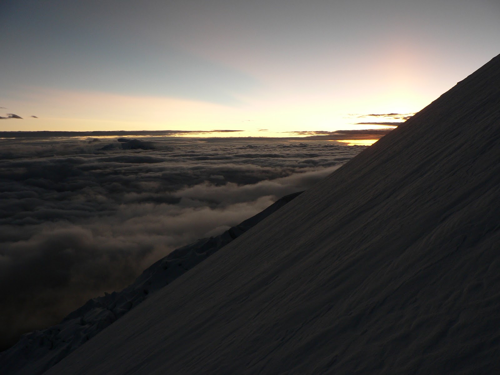
| Storm approaching as we desend into the Green River Valley |
 |
| Our camp on the Green River |
Day 9: Green River to Green River Lakes
We got up at 5 am and hit the trail at 6. We were trying to get out early enough to drive to Rawlins for lunch at Rose's Lariat, a small local mexican resturaunt that is Oh So Good. The walk along the Green River was spectacular and one of the most scenic hikes of the trip. The forest is lush and wet, much like the northwest with fungi and mosses. The landscape is dominated by Squaretop Mtn. with the Green River flowing at it's flanks.
 |
| Yes the Green River is green |
 |
| Squaretop Moutain and the Green River |
 |
| The end of a great trip |
Food that worked:
Ramen Noodles(chicken)
Harmony House Mama Mia vegetable soup
Snickers bars
Nature Valley oats and honey and oats and dark chocolate bars
Idahoan Powdered potatoes
Whole Powdered Milk mixed with powdered chocolate (1/1 ratio)
Instant oat meal
Insant grits
Gouda Cheese
2.25 lbs Jeff's Beef Jerky
1 lb of Walnuts(shelled of course)
Drink mix for flavoring water
Premium saltine crackers
Backpackers Pantry Freeze/Dried Backpacker meals (Beef Stroganoff, Pad Thai, Granola and Blueberries)
Hard pepperoni
Gear that worked:
Katadyn Base Camp gravity feed water filter was indispensible
Nemo 1p tent was awesome(it did have condensation on inside but manageable)
Soto mini regulator stove is the best(It took 2.5 larger isobutane canisters for 9 days)
Western Moutaineering Sycamore 25 degree sleeping bag was perfect
Asolo 500 series boot without GoreTex lining worked great but I would put in a good insert
Gregory Baltoro 70 backpack felt great on back but stitches busted on a couple of seams...bummer.
Tips:
I would definately do the Old Highline Trail instead of the New and take the Fremont Trail and stay high in the mountains where it ends at Cook Lakes instead of going down toward Lake George and Horseshoe Lake on this section of the Old Highline Trail. The New Highline Trail is riddled with bug and fire damage and navigation is difficult and the trail was not maintained very well.
Go in September when you can enjoy the scenery without mosquitos in the ears and nose.
Most groups we met were hiking from North to South but we thought we were going the right direction from South to North because the sun was at our backs most of the time and made sight seeing much more pleasant. Also, the snow packed passes were always on the south side so we were always moving up the snow instead of down(which is more dangerous). The wind seemed to be at our backs most of the trip too, which made it nice.